Tuesday 23 June 2015

Avignon and St Remy

Van Gogh's Olive Trees and Les Alpilles
Final breakfast at Malataverne
Avignon Papal Palace
Golden statue of Virgin Mary on top of Palais des Papes
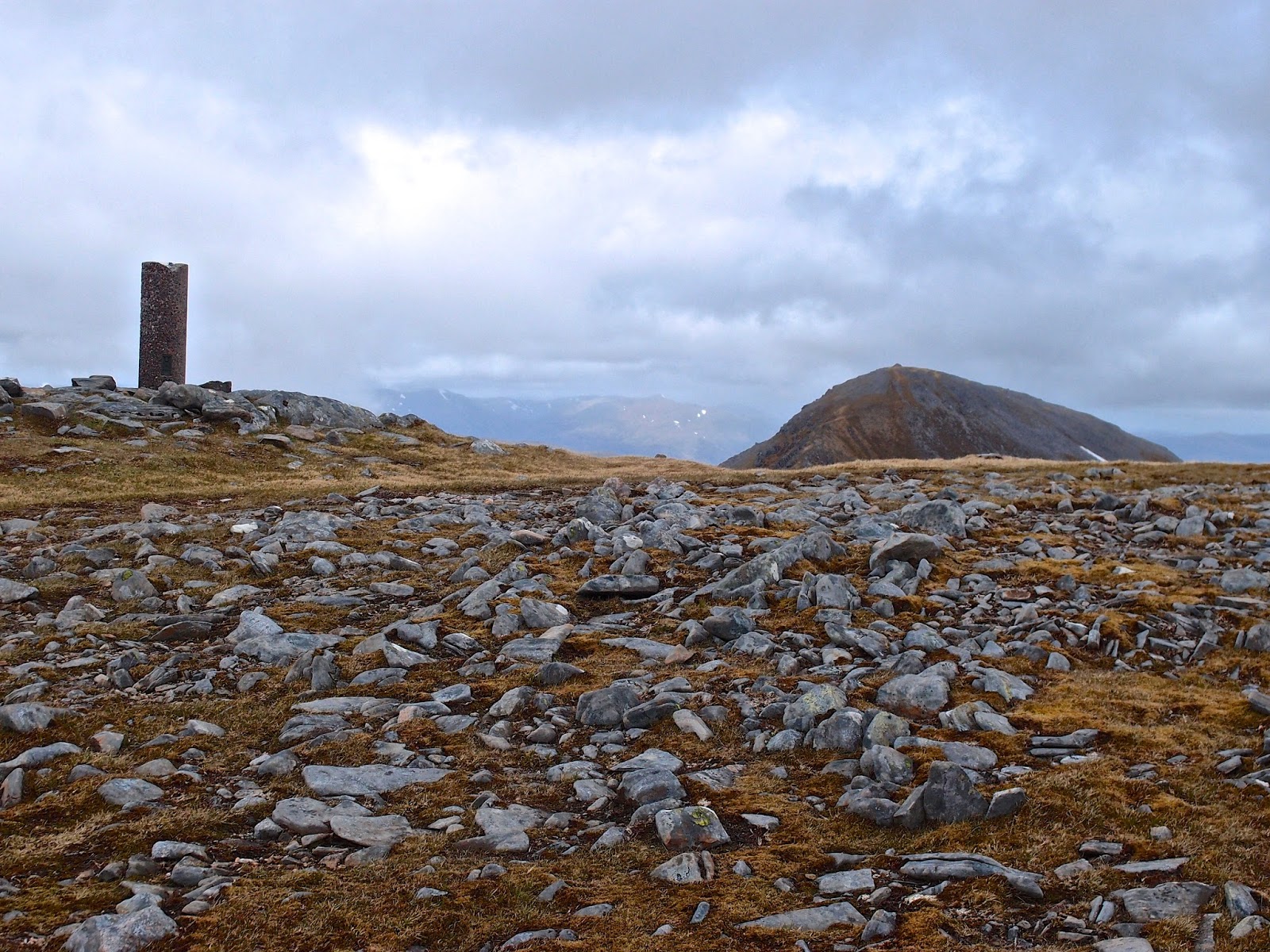
Mt Gaussier
Our annual visit to Le Garn was over and although we had not seen much of the sun this year, the people, the food and the seductive limestone scenery on the plateaux south of the Ardeche had allowed us to relax and enjoy this exquisite location. The final breakfast at Malataverne is always a treat to be savoured until the next visit and we spend a lot of time talking to our host, Evelyn, who has become a good friend over the past 7 years.

We left at 11am on a dull day and drove down the Ceze valley to Bagnols sur Ceze before deciding how to optimise the the day. The trip to the airport at Marseilles is about 100 miles and gives the opportunity to go round or through the historic city of Avignon and 20 miles further to pass through the Alpilles by the town of St Remy en Provence. It is famous as the place where Van Gogh spent his last year in the asylum and produced some of his most inspired paintings. The Alpilles are one of my favourite haunts that provide superb walks and views. As we had a full day to make the journey, we decided to take in Avignon, St Remy and the Alpilles.

Parking at Avignon is always a challenge but today was Sunday and we managed to find a spot on the Boulevard St Michel, that circles the historic walled centre. It was an interesting one kilometre walk to the centre of this remarkable Roman city. The Avignon Papacy refers to a period in the history of the Roman Catholic Church from 1309 to 1378 when the seat of the Pope was moved from Rome to Avignon. The period has been called the "Babylonian Captivity"of the Popes and is why the city is a Unesco World Heritage Site.

We had a lazy Sunday lunch in one of the Place de L' Horloge close to Les Halles, the fruit and vegetable market. We enjoyed the company of an Australian couple who were taking a sabbatical year in France but seemed to have acquired little of French language or customs. Even my limited French proved useful for once. We spent a couple of hours enjoying a tour of the Palais des Papes. The multi media guides were excellent and we left the Palais saturated with knowledge of the history of this remarkable and massive medieval building. It was late afternoon and we resisted the temptation to spend more time in the city centre, which was relatively quiet for a Sunday in late June.

The journey to St Remy de Provence does not take long and we made for the former asylum near the Roman ruins of Glanum where Aileen proceeded to visit the monastery of Saint Paul Mausole Van Gogh, whilst I made my fifth climb up Mt Gaussier, the limestone pinnacle with quite spectacular views over St Remy and as far as Mt. Ventoux 60 kilometres away. The paintings of Van Gogh capture the area with a lens that captivates, unfortunately there was less clarity of the area than on previous visits but this remains one of my favourite short walks or morning runs on the occasions we have stayed in St Remy de Provence.

It was another hour's drive to Marseilles airport where we had booked into a hotel before a morning flight home. The landscapes of the Rhone estuary with its salt flats and the famous Etang de Berre have a strange haunting quality in the Camargue to the west of the Rhone but to the east it has been despoiled by industrial and commercial developments. The petroleum refineries and random commercial developments are a glowing testament to the French ability to create modern ugliness in stark contrast to the sympathetic built environment of villages and small towns. Any attempt at planning seems to have been annihilated by the relentless unsympathetic commercialisation that envelop major airports. The only attraction during the journey was the strongly coloured drying salt lakes as you approach the airport at Marignane.

The airport hotels are dotted around the spaghetti of roads and flyovers that cocoon the airport and finding our hotel in the complex was an exercise in find the thimble. The meal was international cuisine in all its tastelessness and such a contrast to the past couple of weeks when we had become accustomed to wonderful locally produced and cooked french food. Airports have become the symbolic epicentres for abhorrent global franchised capitalism.

Salt Workings on Etang de Berre

Monday 22 June 2015

Ardeche again


Classic Car Rally
Lavender fields, Barjac
Classic Car Rally, Le Garn
Thunderstorm brewing
 Les Vieux waiting for the cyclists
High fives and autographs for the leaders
Recharging
Drawings from the Chauvet Cave
Le Mouton Noir, Issirac
Le Mouton Noir Menu
Darkness settling over the Cevennes
The olive man, Barjac market
Orgnac l'Aven on the morning run
Breakfast
Home for the last 7 years
For five out of the last seven years, we have headed for the idyllic limestone plateau south of the Ardeche gorge. We happened on the area during a driving holiday around the south of France and fell for its tranquil beauty, big skies, local produce and the courtesy of its residents. Usually, we have combined it with a jaunt around other parts of France but this year we just headed for our usual retreat, a stunning Chambres D'Hotes near Le Garn.

The Mas (traditional farmhouse) has been tastefully restored and five rooms have been crafted to meet all the needs of those in search of peace and the flavours of the south. Breakfasts are the stuff of legend as in-season fruits (cherries and apricots in June), a dozen types of jams made with these fruits, local cheeses and homemade cakes jostle on the long outside table beneath the vines. he prospect of such a feast normally prompts a 8 kilometre run to Le Garn and then through the oak forests and along the narrow roads between the lavender fields and vineyards before a swim in the limestone wall enclosed pool that is long enough for a decent swim. Later in the day it is quiet enough to allow a few cooling swims between reading or having a siesta .

The nearby renaissance town of Barjac is off the tourist routes but offers a vibrant market and stupendous views over to the Cevennes. The Ardeche gorge can be reached by a 2-hour walk through the indigenous oak forests and is penetrated by the Grande Randonnee - GR4 - that stretches a thousand kilometres across France from West to East. There are local restaurants that specialise in traditional French menus and nowhere is there any sense of intrusion by the global travel industry. This is France as it was meant to be. Our local was le mouton noir near the village of Issirac which specialised in local cheeses and even had a Rap/Jazz evening. The French rapper chanted about stopping fracking and saving the honey bees, this was sheer localism and stripped of all misogynist lyrics, it was what the Club of Rome was all about.

During our week we watched a classic car rally that epitomised the quirkiness and spirit of friendship that abounds in this corner of France. It was hosted by the local commune, all dressed in yellow who had put out bunting and balloons and provided drinks and food for the mainly older motorists. Four days later it was l'ardechoise, the largest sportive cycling event in Europe with 14,000 riders picking and mixing a selection of routes through the heart of the Ardeche. Le Garn gave the leading riders a rousing reception from Les Vieux who sunned themselves behind the drinks table to the local school children who high fived the cyclists and asked for their autographs.

We visited the amazingly diverse market in Barjac that had more product lines than Tesco and they were mainly locally sourced. We also managed to book a slot to visit the Chauvet Cave, a World Heritage Site that opened in April this year. Its location is superbly set above the Ardeche gorge and no expense has been spared in building a complete recreation of the nearby original cave that has restricted access to archaeologists in order to preserve the paintings. It has the earliest example of cave paintings of animals that are estimated to be 36,000 years old. The site is a credit to the ingenuity and ability of the French to complete big projects. However, the number of visitors in the guided groups was excessive at 30 and together with the snake-like walkway, which resembled the looping of a ghost train at a funfair, somewhat detracted from the experience

We arrived in a tropical rainstorm and for the next three evenings, we witnessed thunderstorms that rolled around the night skies. Then we had a couple of days when the mistral took the edge off the midsummer heat but by the time we left, we were enduring temperatures in the early thirties. It didn't really matter as we sauntered around the cornucopia of nearby walks through olive groves, vineyards and cherry orchards.


Wednesday 10 June 2015

Running for the day


Bluebells and Gorse
Duchray bridge
Loch Ard
At last a morning fit for summer. It was light at 5am and the skies looked promising. For the last three years I have managed to run over a thousand miles but this year is proving more difficult. January started well but then a fortnight in London when running is more of a trial than a trail. February and early March saw me laid low with a virus. April and May were both interrupted by work, holidays and hill walking and now it is June. In reality the weather has just been brawly inclement and not conducive to morning exercise and I seem to have lost the will to run in the evenings

But today was a given day and I was out by 8:30am on my regular trail run over the river, through the forest and past the lochans and lochs. The air was still but had a glorious freshness about it so that when I came to the 7 kilometre mark, instead of turning for home I decided to add on another loop to make a 15 kilometre run. This was the longest run of the year and on the best day of the year so far. The river Forth was still high from the weekend rains but the trails had dried out and for the first time in months there were no puddles to vault over.

The vegetation is about 2 or 3 weeks behind normal, the bluebells are still in full colour and the deciduous trees are wearing their early bright green foliage. I met only one other person out on the trails but disturbed a buzzard feeding on some prey and almost collided with a deer that was grazing close to the path. A Jay squawked at me as it flitted along in frenzied style. Contrary to any logic the run did not tire me but inspired me to cut the lawns and then to go for a cycle ride. Summer oh summer at last.

Tuesday 9 June 2015

Gulvain

Gulvain

Summit? -it ain't necessarily so

Streap and Sgurr Thuilm from the true summit

Man at Top

Gulvain from Braigh nan Uamhaachan

Streap and Sgurr Thuilm from Braigh nan Uamhachan

Braigh nan Uamhachan from south

Monday, 8 June 2015
Ascent:    1495 metres
Distance: 26 kilometres
Time:       6 hours 41 minutes

t    Gulvain south top             962m   2hrs 39mins
m  Gulvain                             987m   3hrs  1min
c   Braigh nan Uamhachan    765m   4hrs 38mins

The summer has been unusually wet and windy even for Scotland. I had planned to spend the weekend in the Fannaichs and Strathfarrar after a trip to Lewis but abandoned the idea when two days of heavy rain and gale-force winds were predicted. The compensation was a day out on Gulvain, not my favourite hill - it is a big bruiser, and then to take in the nearby Corbett.

It was bright and sunny as I left home just after 7am but the cloud cover increased as I drove west and the journey was interrupted by slow caravans and then several roads works with a major delay at the Ballachulish bridge. It was almost 10:30am before I started walking from the cottages at Drumsallie. The walk up Gleann Fionnlighe was delightful, the birch buds providing spring colour and the crystal clear water of the river presenting the glen in the best possible light, there were even interludes of sunshine. It is a long walk of 7 kilometres to the start of the climb, I was passed by a walker on a mountain bike and would probably do the same if I came this way again, although the track was very boggy in places after the recent rains.

After crossing the burn at the foot of Gulvain, the climb began. It is a full-frontal attack of the nose of Gulvain, which soars upwards in a long 850 metre haul up to the first top. There is a path which sometimes just takes the slopes head-on and sometimes zig-zags, either way, it is unrelenting. I could see the cyclist about 300 metres above me and as I reached the 855m outlying top, I could see a couple on the south top. The climb is less steep from here and the trig point was soon reached. The true summit is a mile to the north with a drop of 100 metres between the two tops. At the bealach I met the cyclist on his way back, he was intending to head to Knoydart for a couple of days but the rough bounds were enveloped in dark clouds and he was having second thoughts, which I encouraged. Knoydart is too good for typical Scottish weather.

As I reached the summit, the couple I had seen ahead were about to leave, they were now exiled in the south of England and spent a week every year climbing the munros, they had 50 left to do but many of these were singletons that they had missed during the bigger walks when they had lived in Scotland. When they left I settled down to some lunch, it was reasonably warm although the clouds were still threatening rain. For the first time I reflected that this could be my last time on this Munro, it is not one I would rush to visit unless I attempted a sixth round. I retreated to the bealach and then started the extremely steep descent down the west flank threading my way through the rock outcrops and eventually reaching the peat bogs that had to be crossed to reach the knolly eastern ridge of Gualann nan Osna that leads to the summit ridge of Braigh nan Uamhachan. After the peat bogs, the climb was relatively easy, just 250 metres and lots of rock to provide a better footing than the soft wet ground.

The summit ridge of Braigh nan Uamhachan had that lovely Corbett like quality, short grass, rocky knolls and comparatively gentle slopes. I arrived at the summit from the north at the same time as a walker appeared from the south. I would not have expected to meet anyone here in a month of Sundays. He had climbed Streap and then battered his way up the western flank of the hill. We chatted for 10 minutes as we ate some food and took a breather. His demeanour was pure Glaswegian, only 12 munros to go and working his way through the corbetts as well but completely nonplussed about the names or recognition of hills, he just liked walking on them.

The descent from here was over Sron Liath (683m). It was ridge walking at its best, the recently arrived afternoon sun lit up the views and provided a rare warmth in this cool wet summer. I made a long traverse down the eastern side of the hill reaching the track to Gulvain just south of its termination. It was later than I had hoped but I had taken time out at the summit of both hills and spent 20 minutes or so talking to other walkers, it was that sort of lazy day on the hills. To compensate I set a fast pace down the track which I managed in just over an hour, not bad for 7 kilometres. It was well after 5pm before I started for home but the roads were empty and I shaved an hour off the time taken for the outward journey in the morning. 

Saturday 6 June 2015

Lewis, Outer Hebrides


Callanish

Lewisian Gneiss wall

Sheep, peat, water

Callanish Stone Circle


2700 million years younger than the child

Callanish Bunny

Gearrannan Black House village
Gearrannan self-catering cottages

Barvas Beach


Stornoway Harbour, Lews Castle in background

Herring Girl
It was only my third trip to the Outer Hebrides and, although here for work, I arrived early enough to hire a car for half a day so that I could take a tour of the west coast of Lewis. On my first visit, we had cycled to South Uist and back, camping on sandy beaches. On my second I was an external adviser for the appointment of a Director. In the evening I climbed Clisham, the highest mountain on Harris in low cloud. I had never explored Lewis with its peatlands, wild beaches, an abundance of eagles, fascinating geology and historical legacies.

We have a watercolour painting of Lewis at home bought after our first trip; its images are of telegraph poles and scattered cottages in the peatlands below sombre skies. I felt as if I was in the picture today when I drove across the brown peat moors which merged into the pale grey clouds on the way to Callanish. Here a circle of indigenous gneiss stones, the highest of which is 15 feet tall, were erected 5000 years ago. The central group of stones are surrounded by lines of stones to the west, east and south. To the north, two lines of stones extend about a hundred yards towards the grazing lands of the crofts. There were quite a number of visitors hanging about the stone circle so I took the opportunity to have a late lunch of tea and cake before returning to the stone circle after most of the other visitors had departed.

I drove north to Gearrannan where a village of black houses tumbles down to a sea inlet. They were occupied until the late 1950s and have been restored by the Gearrannan Trust, supported by the Council with dollops of funding from Europe and expertise from Historic Scotland. It was early evening and the museum was closing so I walked down to the sea and spoke to some cyclists who had rented the self-catering cottages that had been fitted out by the trust.

Time was limited so I continued along the coast road to the junction at Brue, where the A857 meets the A858. Vehicles from Stornoway were moving at excessive speeds so I decided to avoid the crazy driving by turning off to Barvas where there is a beach at the end of a track that winds its way over the machair. It looked wild with the Atlantic waves crashing in, they had created a massive wall of large gneiss pebbles. Apparently, it is a famous windsurfing beach which probably explained a couple of VW camper vans that were parked beyond the end of the track.

The road back to Stornoway was a long straight ribbon of asphalt through the peatlands. The peatlands have been artistically vandalised by pylons, wind turbines and telegraph poles but at least they punctuated the monotony of the Lewis Peatlands Special Protection Area. Fortunately, the massive wind turbine farm proposed for this area was refused on the grounds that some 230 pairs of dunlin would be displaced by the development and 5700 hectares would be affected by disturbance and displacement. In addition, there is currently no interconnector to allow the export of electricity to the mainland.

After a splendid night at the Digby Chick seafood restaurant with my learning set, I rose early and took an early morning run through Stornoway and around the grounds of Lews Castle. I was surprised on entering the Lanntair Arts Centre, our venue for the day, to discover a hundred or so youngsters arriving for the local Mod. I wound up our session at 4pm and gave myself 20 minutes to charge around the town taking photos before catching a taxi to the airport for the flight back to Inverness. I really need to plan a proper visit to Lewis and Harris but when I looked earlier this year most of the accommodation was booked up and I am not sure that cycle camping would be appreciated any longer.

I flew back with one of the Directors I was mentoring and we had some time in the airport together as we waited for the delayed plane. I sadvised him to apply for a Chief Executives job that he was uncertain about, he did and he got the job. The flight back gave wonderful views of the Summer Isles and then the wild country north of the Beinn Dearg group of mountains. We flew right over Ben Wyvis and I was able to pick out my route of ascent from a few weeks ago. Inverness like all the airports on the northern isle is a travellers dream. No queues, quick exits and no hassle. I had all my walking gear in the car and had intended to walk the Fannaichs the next day but gale-force winds and heavy rain were predicted so I headed home down the A9.