Saturday 30 April 2016

Glen Fruin Graham(s) Beinn Chaorach

Beinn Chaorach from the south

Saturday, 30 April 2016
Ascent:       798 metres
Distance:    10 kilometres
Time:          3 hours 7 minutes

Beinn Chaorach         714m   1hr 30mins
Balcnock                   693m   2hrs 13mins

It was the Bank Holiday weekend and I had agreed to a walk with Gregor. After the snow of the past two days and a forecast of more rain/snow today we thought a shorter outing in the morning would be preferable to a long drive north to climb some remote munros. Gregor suggested some of the Grahams by Loch Lomond so we could start early and finish by lunchtime. I consulted the SMC Guide to the Grahams and thought that the two Grahams that lie north of Glen Fruin seemed a good pairing. We met at Lomond shores in Balloch at 8:30am to dump one of the cars and drive the 10 miles to the start of the walk in Glen Fruin.

There is parking for about 4 cars by the new bridge on the A817 at Ballevoulin. It is directly across the road from a gate that leads into a field that provides access to the obvious ridge that climbs northwards to Beinn Tharsuinn and on to Beinn Chaorach. The map was in my rucksack, which was in the boot of the car, and when I saw the profile of the hill and the parking place I assumed that we were 3 kilometres further along the road at Auchengaich and that the hill was Beinn a' Mhanaich, the hill I had intended to climb first. It was in fact Beinn Chaorach and for the first time in over 800 walks I made the mistake of climbing the wrong hill. The similarity of the two hills with long north south ridges meant that it was only on the final ascent that I began to have doubts about our position. By this time conditions were too wild and the visibility very poor, so I didn't get the map out, we just battered on to the summit.

The initial slopes were slightly boggy but the gradient allowed a steady pace whilst we discussed Gregor's excellent run (2hours 40mins) in the London Marathon last weekend. We were at 500 metres where the slopes tapered and it became a pleasant stroll along the ridge but storm clouds were gathering. We took the opportunity to get a few photos and then we were enveloped in a heavy snow shower and visibility dropped to less than 100 metres. We passed another walker and reached Beinn Tharsuinn. We could not see the summit and by this time we were having to negotiate pockets of deep snow. There was a further ascent of about 100 metres before we reached Beinn Chaorach (or Beinn a' Mhanaich as we thought) just as the low clouds began to scud away.

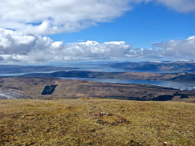
Ten minutes later it was a sunny morning with crystal clear visibility of the hills ahead and the Firth of Clyde behind. There was also a very clear view down to the Trident submarine base at Faslane on the Gare Loch. We were feeling pleased with our choice of hills as we retreated to Beinn Tharsuinn. The views were expanding all the time - towards Greenock, Gourock and then the peaks on the isle of Arran hove into view.

We began the drop to the bealach before the next climb to the impressive looking 693m top north of Balcnock. We were still walking under the illusion that we were climbing Beinn Chaorach although the drop to the bealach was not nearly as great as the map suggests. We were enjoying the walk too much and the views were splendid so why worry if the climb was a lot easier than expected, it usually works the other way round. We continued over the 693m top down to Balcnock by which time I was convinced we were not in the right place.

Whilst contemplating this I fell through a layer of fresh soft snow into a 4 feet hole of waterlogged peat, it took a few minutes to extricate myself. We found our way down the steep south westerly flank of the hill to the burn. What had happened to the reservoir? Well it was where it should be 2 kilometres to the north west. We could see the car and we had completed the round in little over 3 hours and felt very positive about the walk. I even found a patch of primroses, more than I had achieved in sunny Knoydart last week. It was not yet 1pm when we reached Lomond shores after passing lots of army manoeuvres.  Gregor dropped me off and returned to Glasgow, I had a simple half hour drive to be home almost an hour ahead of schedule. Going up the wrong hills has some positives.

Summit trig point on Beinn Chaorach
Looking south west over the Firth of Clyde, Arran in far distance
Trident depot on Gare Loch
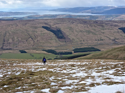
Descending Beinn Chaorach, Balcnock ahead 
Descending Beinn Chaorach
693m top and Balcnock
Looking north to Arrochar Alps
Final descent to Glen Fruin with Firth of Clyde in distance

Monday 25 April 2016

Tandem away


Claud Butler tandem frame
I gave away a family heirloom today and have a few pangs of guilt. The family tandem was bought shortly after I was born and was my main mode of transport for the first four years of my life until my sister arrived on the scene. My father had been a keen cyclist and he bought a tandem so that he could rediscover in tandem with my mother the haunts that he had cycled round before spending the war years with the Eighth army in Africa, Greece and Italy.

It was a beautiful Claud Butler tandem made in the 1940's, painted a metallic blue with a three speed deraillier gear. At weekends I would be wedged into a baby seat over the rear wheel behind my mother and we would go to Lytham, St Anne's, Southport or towards Morecambe Bay. Apparently I would fall asleep after a few miles on the return journey and this would lead to an edgy discussion whether they should stop and let me sleep at the roadside but this may have been a ruse by my mother to have a rest sitting on a blanket until I woke up. Panniers were needed for the blanket, my bucket and spade and a picnic lunch along with capes, a toolkit and other paraphernalia. In the evenings we would use the tandem to visit my other set of grandparents or head up the Ribble valley.

After my sister arrived I was promoted to a child seat on the rear cross bar and my sister took her place in the baby seat. By this time we had moved from my grandparents house in the town to a new house on the outskirts. My mother rebelled against pedalling two children and a bike that must have weighed a hundred weight (cwt) including the child seats and the panniers. The bike got stored in the tool shed and then transferred to the attic from where I rescued it fifteen years later.

I didn't use it very much, it did not have the same pulling power as a car in the 1970's, so once again it was relegated to a cellar and then a garage. I had a notion that I might want to restore it once I retired but I have not had the inclination or the patience to tackle the sturdy but rusting steel steed. I was talking to one of the bike mechanics in the local bike recycling factory and mentioned the tandem. He said a friend would love to restore it. When I took it in there was an excited gabbling amongst the bike enthusiasts, they were all staggered at the weight of the frame, they obviously didn't know what a hundred weight was.  I hope the friend is able to restore and get some use from it. Far from feeling I had given away a heirloom I felt a sense of relief, I had now recycled four bikes in the last two years but still have a three left, less bikes means less hassle and more cycling.

Sgurr Coire Choinnichean and Inverie


Sgurr Coire na Choinnichean from Loch Nevis

Friday, 22 April 2016

Ascent:        892 metres
Distance:      12 kilometres 
Time:            3 hours 25 minutes

Sugar Coire na Choinnichean    798m     2hrs  2mins

We awoke to another glorious sunny morning in Knoydart and only with one nearby corbett to climb, it would be an easy morning walk. We had decided to leave on the 4:15pm ferry rather than starting to walk by 7am, which would have been necessary to catch the 11am ferry. The beach campsite was simple bliss, the sun was warm, the midges had yet to arrive and the wind was in abeyance. Only two others campers were on the site: a Californian who had spent the night under his tarp and a potter from Nethy Bridge who lent us his stove to make a brew of tea when our gas ran out. There are benches at each of the flat pitches and they proved useful for drying out sleeping bags and packing rucksacks before we set out. A lone female runner jogged past with a collie dog at her heels, there was not a ripple on the seawater 30 metres away until a boat arrived at Inverie pier a mile away, several minutes later there was the gentle lapping of its wash on the beach.

We walked the mile into Inverie and seeing the Californian sitting outside the Tea Room in the morning sun tucking into his hearty breakfast we decided to return here for lunch. We took our time strolling through Inverie and read about the Knoydart Foundation that has carried forward the work from the Community buyout in1999. The track that leads north from Inverie along the Allt a' Mhuilinn provided an easy walk to where we dropped our rucksacks at the end of the forest and headed up the west flank of the hill. There were 350 metres of mindless ascent through the faded yellow grasses still yet to green into life, they were dotted with bright yellow primroses. Arriving on the plateau of Coire Choinnichean the impressive crags that guide a burn down to Inverie House provided a fine mountain view. I wondered whether there might have been a more direct route up but too late now. We walked around the end of the crags and then headed for the knife-like ridge that leads to the summit of the hill. 

It is a wonderful climb of about 250 metres, a path that snakes through the crags and gives a bird's eye view of Loch Nevis. There is a false summit at about 770 metres before a final 400 metres across a dip and rise to the actual summit at 796 metres. I tidied up the cairn before eating my last 'marathon' bar and scrounging some water from John, I had left my bottle in the rucksack. We retraced our route on the descent, the spectacular views making it the perfect end to our 48-hour epic trip into Knoydart. The only regret was that I could not find the clumps of primroses for a photo on the descent but we now had our thoughts on the cafe and some real food. The cafe is run by three local women, the soup was thick enough for the spoon to stand and tasty enough to eradicate the diet of dehydrated food, oatcakes, nuts and energy bars that had sustained us over the last couple of days. We ordered a teapot of tea for four and we were happily reunited with civilisation. 

Our Irish acquaintance from yesterday walked in having climbed Ladhar Bheinn and we spent an hour telling yarns about hills, equipment, people and places. By mid-afternoon, we sauntered along to the pier and I spent another 45 minutes in conversation with the Nethy Bridge potter, the others joined us and the banter was four age advantaged mountain obsessed men waiting for a boat. Inverie and Knoydart had provided near-perfect weather for an arduous and unforgettable two days collecting six rough, tough mountains.

On the ferry, the wind had blown up so I went below deck and chatted to one of the boat owners about the recent changes to the ferry service. The competing sea bridge operation had ceased at the start of the season and their fleet of 4 boats had been taken over by the Western Isles ferry service They were going to sell these boats that were fast but noisy and fuel-hungry and buy a more sustainable catamaran to augment the 75-year-old 'Western Isles', the sturdy boat that had been built as a supply vessel and was now the mainstay of the Knoydart ferry service. We arrived in Mallaig shortly after 5pm and resisted a fish supper on the day that the fishing boats had come in. The drive home was on quiet roads and took less than 3 hours mainly because driving through Glencoe and over Rannoch Moor was unimpeded by slow traffic or motorbikes. It is amazing how speed creeps up when you are hungry.

Inverie long beach campsite

Loch Nevis from the campsite

Communities do it for themselves

Ascent of Sgurr Coire Choinnichean ridge

Sgurr Coire Choinnichean summit

From the summit

Crags at Coire Choinnichean

Egg and Rum beyond Loch Nevis

Inverie pier - the arrival of Knoydart ferry

Inverie

Knoydart ahoy

Skye ridge over the waves


Sunday 24 April 2016

Luinne Bheinn and Meall Buidhe

Luinne Bheinn from wild campsite above Mam Barrisdale

Thursday, 21 April 2016

Ascent:        1644 metres,  
Descent:      2210 metres
Distance:    19 kilometres
Time:         10 hours 41minutes

Luinne Bheinn        939 m        1hr  58mins
Meall Buidhe        946m         4hrs 37mins
Beinn Bhuidhe        855m         7hrs 42mins

Day two of the Knoydart adventure began with a spectacular view of Luinne Bheinn as I unzipped the tent door. Blue sky, coolish but not too windy. John was making a brew, we had agreed to start after 9am given the late finish yesterday. We had pasta for breakfast, it had been too dark and too cold to cook it last night. By the time we set off the clouds were drifting in and I expected rain later in the day. After dropping down and crossing the path at Mam Barrisdale we followed a path to the west of the mountain. It climbed less steeply than the route up and over Bachd Mhic an Tosach, which I had used on previous visits, and took us south west of the mountain from where we had a very steep climb up grass and rock slopes to the summit ridge. On reflection it was a mistake. We continued to the summit at the trig point where we stopped for some food and drink. Meall Buidhe was in cloud but by the time we started walking again things were beginning to clear. 

There is a good path leaving to the south east that twists down the ridge and then turns south west before reaching the bealach at 693 metres. We met an Irish walker coming the other way and spent ten minutes in animated conversation. He was doing our round in reverse but without the corbetts. We were envious of his minimalist gear although when we heard the story of his tarp the following day we relented on envy and gave him a hard time. We continued across the rough but enjoyable  ridge that traverses two more tops before the final bealach at 712 metres. Then there is a 230 metre climb to the south east top of Meall Buidhe. We arrived at the summit as the sun became ascendant and spent half an hour on the summit. It was warm, still and the visibility was excellent.

We returned to the top and found a reasonable footpath which dropped us down to the ridge above Mam Meadail. The last 250 metres of descent was a free route between the crags, steep but not that difficult over the dry ground. We reached the bealach and immediately began the climb up to Meall Bhasiter, the first top on the 8 kilometre long ridge. We were privileged to have the views of Loch Nevis to our left and the Knoydart munros of the last 24 hours to our right. The walk was undulating but always of interest. The climb to the 802 metre top just east of Beinn Buidhe had a couple of exposed steep climbs but by this time we were beginning to have concerns about getting back to Inverie before last orders for food and simply charged up the scrambles. We continued to the end of the ridge at Sgurr Coire nan Gobhar and descended the ridge to the south west as advised in a couple of guide books. We then negotiated a route down the Coire above Loch Bhraomisaig until we reached the boggy ground that circles the loch.

And this is where it became tricky, trying to find a route down to the Inverie river, 330 metres below, was an exercise in trial and error. We eventually decided to cross the Allt Dubh and dodged down the hillside where crags and bogs competed for bragging rights. On the lower slopes fences had been erected to safeguard the hillside from deer. Young birch saplings and primula were thriving but it made travel even slower. I headed for the Kilchoan estate and after another four or five fences we crossed the river on a newish wooden bridge and then made our way across a boggy field to the campsite on long beach. 

I pitched my tent in double quick time and left John to finish erecting and sorting his tent whilst I raced along to the Old Forge pub to order food, I arrived with two minutes to spare and had finished my first pint before John arrived. The Swiss and Scottish acquaintances of yesterday were well into their food and drink. They seemed surprised that we had made it and others were equally amazed that we had got round Knoydart in two days although they were sunny and dry. It was after 11pm before we began the one mile trek back to the tents. The reward was a level camp site, dry ground and a balmy moonlit night with the stars twinkling in the clear night sky. Sleep was guaranteed after two long days completing a Knoydart round. Sgurr Coire Choinnichean in the morning seemed like a bonus hill.

Booting up for the day

Looking back to Luinne Bheinn from the ridge to Meall Buidhe

Schist sculpture

Summit of Meall Buidhe

Head of Loch Nevis from Meall Bhasiter

Sgurr na Ciche and Garbh Chioch Mor

Summit of Beinn Bhuidhe
Descending Meall Buidhe
Looking across to Meall Buidhe 
Beinn Bhuidhe from Sgurr Coire nan Gobhar

Ladhar Bheinn


Ladhar Bheinn summit ridge looking east

Knoydart is reputedly the roughest, remotest walking area in Scotland as well as having the highest rainfall. The most remote part of Knoydart, west of Barrisdale and Sourlies, contains three of the toughest Munros and three Corbetts. These were our objectives and we had planned it would take four days. Good weather would be an advantage so as soon as we spotted the chance of three possible dry days we decided to go. We estimated that if we wild camped we could possibly complete the six hills in three days. As a result of other engagements, this was then restricted to three days including the travelling, putting further pressure on ourselves.  It is a three and a half-hour car journey followed by another hour for the ferry trip from Mallaig to Inverie so only one full day and two half-days for walking. In the past, it would have been no problem but age and full rucksacks do not speed you up.

Nevertheless, it was an exciting adventure, I had previously climbed the three munros from Kinloch Hourn on three occasions and once by a long walk in over Gairich, Sgurr Mor and Sgurr na Ciche. They had been amongst the longest and hardest days I had encountered during my adventures on the Scottish mountains.

We decided to make a clockwise circuit of the hills starting from Inverie with the intention of climbing Beinn an Calliche and Ladhar Bheinn and to camp near to Mam Barrisdale at the end of the first day. We would then climb Luinne Bheinn and Meall Buidhe followed by the massive Corbett, Beinn Bhuidhe on day two, before returning to Inverie to the beach campsite. We hoped that we could make the pub for a meal and a couple of pints before last orders at 9pm. The final morning we would climb Sgurr Coire Choinnichean if our legs permitted. The problem was carrying all our gear and food for two days at a time of year when we needed the clothing and equipment for all eventualities. A full 46-litre rucksack with 2 litres of water is not an easy carry when there are over 2000 metres a day to climb.

Sailing into Loch Nevis: SCC, LB, MB and BB all visible

The track from Inverie towards Ladhar Bheinn

Beinn na Caillich

Looking south-west to Eigg and Rum from Beinn na Caillich

Route up An Diollaid

Ladder Bheinn Vanessa trig point and summit ridge

Bein Sgriol over Loch Hourn

Loch Hourn beyond Stob a' Chiore Odhair

Stob a' Chearcaill over Coire Dhorrcaill

Sunset looking west to Skye

Wednesday, 20 April 2016

Ascent:      2005 metres   
Distance:   21 kilometres
Time:         9 hours 20 minutes

Beinn na Calliche        798m     3hrs 25mins
Ladhar Bheinn           1020m     6hrs 38mins     

The A84 had been unusually quiet although leaving home at 6:30am had saved 15 minutes, more than enough to compensate for the road resurfacing beyond Tyndrum and the school traffic in Fort William. We caught the western isles ferry from Mallaig to Inverie with plenty of time to spare, The sea was calm and an international naval exercise was in operation in Loch Nevis. The two BT Open Reach engineers were speculating on how the different navies communicated, it certainly wouldn't be by any broadband connections. They had a ladder and some pliers with them to wire up some properties on the peninsular. It seemed as if half of Inverie was there to meet the ferry, more Land Rovers were on the pier than in the Tata factory.

We wasted little time negotiating the boxes of food, packages, Land Rovers and people; this looked like island life, which I suppose it is given that the only access to the peninsula is by sea. We heaved our heavy sacks onto backs and began the steep climb up the gravel track leading north from the village. to Mam Uaine. The weather looked as if it may stay dry as we emerged from the forested slopes to look across at the massive profile of Ladhar Bheinn and the less impressive gentler profile of Beinn na Calliche. This was our first objective. There is a track that drops down to Gleann na Guiserein with a couple of gates to go through before reaching a bridge over the river at Folach. We were passed by a Land Rover driven by a Knoydart ranger with a couple of clients aboard, they were going to look at the Eas a' Chaorainn waterfalls. We passed them 10 minutes later as we made our way up the glen before dropping our sacks at 180 metres, eating some lunch and then making a beeline for the steep eastern flank of the hill. 

I managed across the river with dry feet thanks to some Goretex gaiters and we were accosted by the sun as we climbed. I came across a large mountain moth that has been recognised from a photograph by John's moth expert friend as a rare emperor hawk moth. It was a tiring ascent of about 3 kilometres to reach the flattish summit. There were good sea views to the west but the steep flanks of Ladhar Bheinn to the south-east were more disturbing. They left us in no doubt that it would be a stiff climb in the heat of the afternoon sun.

The descent was much quicker, the ground was relatively dry with last year's long grass a wilted straw colour providing a cushioned sometimes precarious footfall. We collected our rucksacks and wasted little time before starting a direct ascent of 500 metres by threading our way upwards by a series of ramps between the crags as we climbed to the bealach beyond An Diollaid. Despite removing my jacket and pullover the sweat was effusive even running down the inside of my sunglasses. It was with some relief that we met a young Swiss woman and Scottish man at the bealach. It gave us time to cool off as we engaged in a long talk. The Swiss woman seemed genuine in her appreciation of the Scottish Mountains, they are not domesticated with graded paths and mountain huts. Ladhar Bheinn had been her 43rd Munro.

Although the final climb to Ladhar Bheinn is little more than a kilometre it is a long pull up a well-defined path. The visibility was improving all the time as the sun began to sink and the views into Knoydart conjured up happy memories in this haven of rough, tough terrain. Loch Hourn was a twinkling snake of cobalt blue below and the ridge began to reveal its snow laced apex. There are few finer locations than the summit of Ladhar Bheinn particularly at this time of day. The Vanessa trig point was broken and we continued to the true summit along the narrow path that meanders along the ridgeline. We stopped for photos and to revel in the spectacular mountainscapes in all directions. Beinn Sgriol seemed a stone's throw away across Loch Hourn and as always the loch was mightily impressive as it fingered its way up to Kinloch Hourn beyond the impressive outlying top of Stob a' Choire Odhair.

The route from here is a descent to the south-east, overlooking the menacing Coire Dhorrcail. There are some tricky scrambles and at one stage my framed rucksack became ensnared on a rock ledge with a 10-foot drop unless I could free it. Normally I use smaller unframed rucksacks and I was regretting carrying 46 litres of load space, which is merely an invitation to take all those extras like a spare pair of gloves, phone charger, second pan and several dry bags. It was an hour and a half before we reached the end of the undulating ridge at the 849-metre point. There was a large patch of snow at the same place that we had found one in 1993 on our first visit to Ladhar Bheinn. On that occasion and going in the opposite direction on a hot afternoon I had stripped down to underpants and cavorted and rolled in the snow like a puppy before starting to climb the ridge.

This time we put on gloves as the sun sank behind the ridge and we descended down towards Mam Barrisdale. We found a good path for the first 200 metres of descent then headed down the peat strewn slopes searching for a source of water for a campsite. We were down to 630 metres before we found a burn with any water. Despite having the highest rainfall in Scotland the burns were running dry and mostly underground beneath the deep peat slopes on the hillside. 

Although there was a full moon the light was fading fast and the temperature was plummeting beneath the clear skies. The ground was uneven and boggy and by the time we had had a brew of tea and some soup we were too cold to be bothered making anything else to eat, a handful nuts and raisins would have to suffice. Removing boots is one of those magical moments after a day like this and slipping into a sleeping bag was all that was needed before sleep enveloped the day.

Tuesday 5 April 2016

Academies, but we're not afraid

A big dark academy
We can't go over it.
We can't go under it.
Oh no!
We've got to go through it!

Listening to friends in England talk about schools makes me despair. Schools are subjected to ever increasing control from central government and its inspection agencies. In many parts of England as funding has been stripped from education authorities for new school building, it has become a lottery to get a place in existing overcrowded popular schools. It partly explains the unnecessary traffic jams as pupils get driven across towns and cities to distant schools instead of walking or cycling to the local school. No wonder that parents and teachers are frustrated and stressed by what should be the joy of watching their charges become inspired, creative and knowledgable young people.

Michael Rosen in a well crafted article this morning dismisses the entire farrago of a policy proposed by Nicky Morgan, the Secretary of State for Education. She was no doubt prompted by the Chancellor to transfer all schools from local education authorities to academies. Schools were conceived, built and run locally run by a democratic organisation that also has responsibility for children's services, libraries, sport, transport, and housing, all of which can improve the functioning of schools. If they are transferred to academies run by trusts and often packaged together with other schools not necessarily in the same area, and parental involvement is denied then the very essence of a school community is threatened. The investment in school buildings and land made by local education authorities for the benefit of their communities will be divested to trusts and organisations that are more concerned about executive pay and profit than community well being.

This may be a sinister trick by the Chancellor to radically reduce the state funding of education in the long term. After all academies do not have to employ qualified teachers nor are they subject to the overelaborate and damaging inspection regime imposed on schools run by education authorities. Nor will the academies be responsible for providing for the most needy children or required to employ the panoply of professional support that they require. This is perhaps a government policy initiative too far that will receive the backlash it deserves from parents, teachers and councils of all political persuasions. They are not afraid of challenging the government on this ill conceived initiative. Who better than Michael Rosen, the author of 150 children's books and former Children's Laureate, to diss the proposed academisation of education.